
WebViewer Help
Help with the Online version of the Riverscapes Viewer
The Riverscapes Web Viewer is a browser based application within the Riverscapes Data Exchange for viewing the geospatial data within riverscapes projects.
Unlike the Viewer of QGIS Riverscapes Viewer or ArcGIS Riverscapes Viewer, the Riverscapes Web Viewer is a simplified version of a GIS viewer that is designed to be easy to use and accessible to all users. It is not as powerful as the desktop GIS viewers, but it is much easier to use and is accessible from any device with a web browser. You do not require GIS software to use the web Riverscapes Viewer.
Getting Started
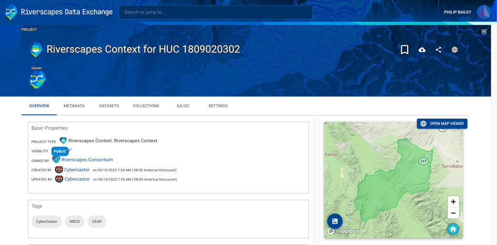
Visit the Riverscapes Data Exchange and identify a project for which you want to view the data. You can search for a project by name or by location.
Fro mthe project page, click on the Open Map Viewer button located at the top of the map preview.
The Map Viewer
The Web Viewer is centred around an interactive map of the layers in the project. On the left is a project tree (#1) that shows all the layers in the project. Double clicking a layer adds it to the map (up to a maximum of 5 layers). Each type of project has a different set of layers and organization. Right clicking on a layer also allows you to add it to the map or view layer specific information, such as the provenance of where the data originated.
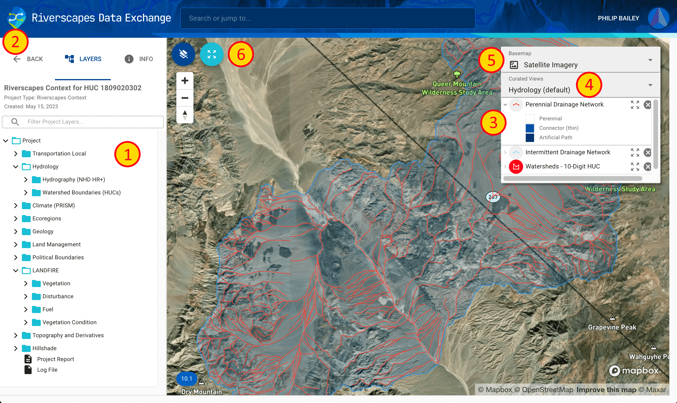
Above the project tree are three controls (#2) that let you return to the Data Exchange, switch to the layer list, or view project level metadata for the project. The info tab includes a button to download the project together with all its data should you want to use it in a desktop GIS using either the QGIS Riverscapes Viewer or ArcGIS Riverscapes Viewer.
On the right side of the map is a legend (#3) displaying the layers that are currently loaded into the map. Buttons for each layer let you expand or collapse the legend, remove it from the map or zoom to the extent of the individual layer.
Each project type can have several curated Views (#4) that are designed to show a specific set of layers and settings. Choosing one of these views will change the layers on the map to match the view.
You can pick from one of three basemaps (#5) to change the background of the map.
Finally, you can control the visibility of the project tree, zoom in and out and also zoom to the extent of the project (#6).
Need more help?